Bristol and Bath A-Z Street Atlas: Accurate street map for easy navigation (A5) (Eighth edition)
Bristol and Bath A-Z Street Atlas: Accurate street map for easy navigation (A5) (Eighth edition)
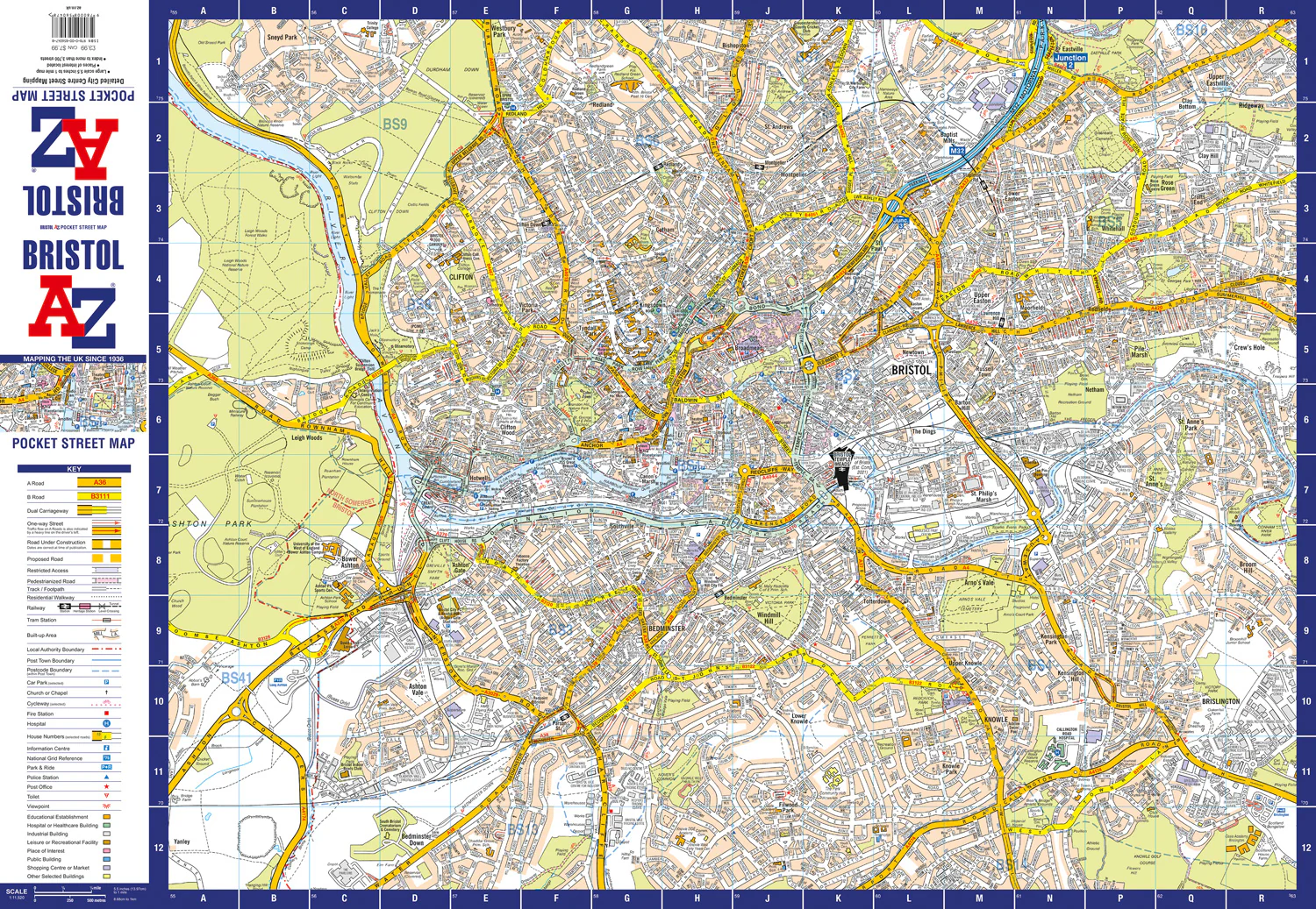
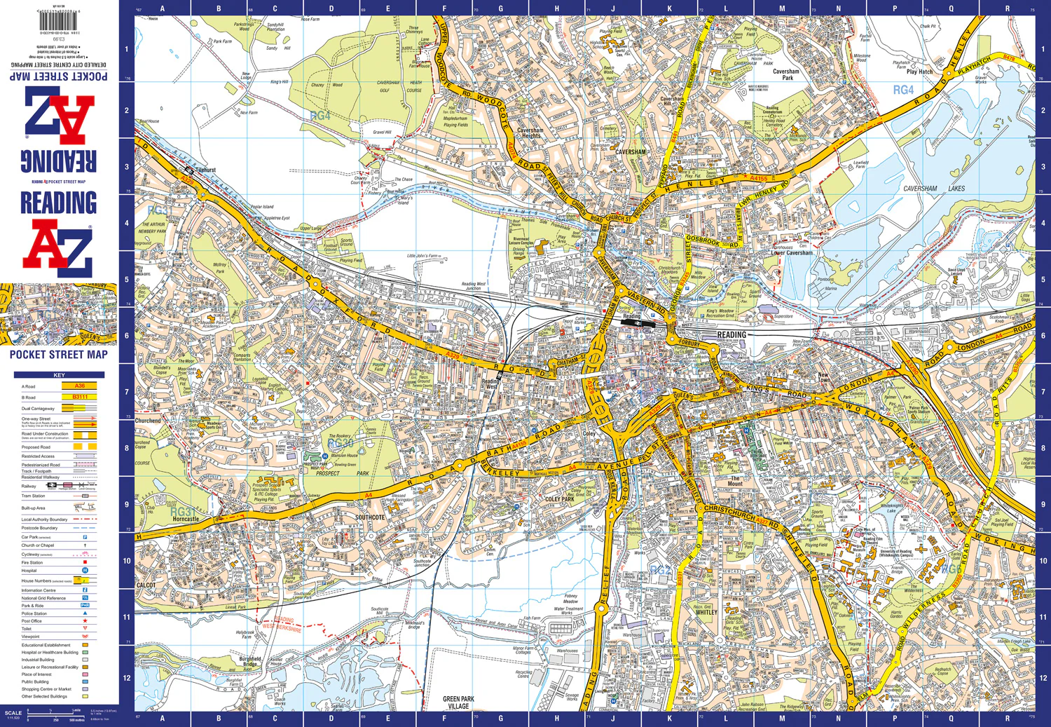
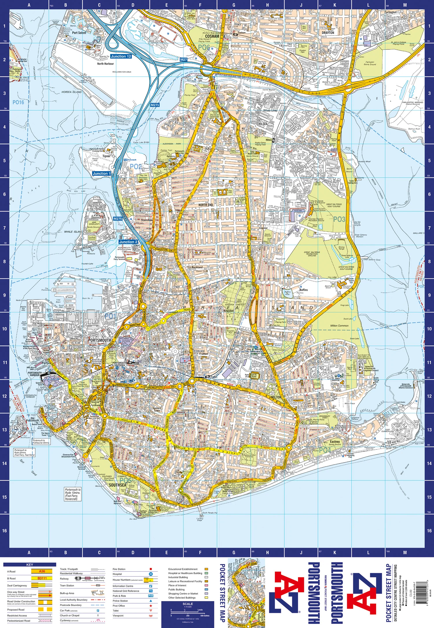
Navigate your way around Bristol and Bath with this detailed and easy-to-use A-Z Street Atlas.
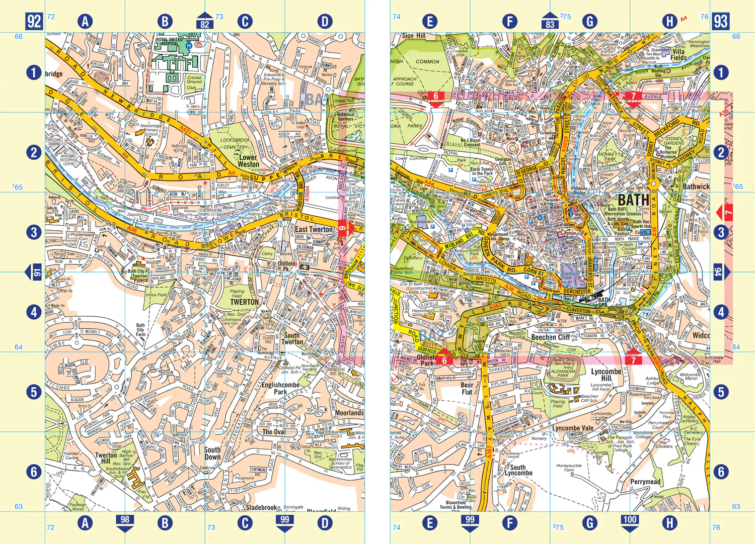
Printed in full-colour, paperback format, this atlas contains 96 pages of continuous street mapping in a NEW A5 format for ease of use.
Areas covered include: Olvestone, Avonmouth, Patchway, Kingswood, Keynsham, Dundry, Frampton Cotterall, and Bradford-on-Avon.
Also included are large scale city centre maps of both Bristol and Bath.
A comprehensive index lists streets, selected flats, walkways and places of interest, place, area and station names. Additional healthcare (hospitals, walk-in centres and hospices) and transport connections are indexed as well.


Description
Navigate your way around Bristol and Bath with this detailed and easy-to-use A-Z Street Atlas.
Printed in full-colour, paperback format, this atlas contains 96 pages of continuous street mapping in a NEW A5 format for ease of use.
Areas covered include: Olvestone, Avonmouth, Patchway, Kingswood, Keynsham, Dundry, Frampton Cotterall, and Bradford-on-Avon.
Also included are large scale city centre maps of both Bristol and Bath.
A comprehensive index lists streets, selected flats, walkways and places of interest, place, area and station names. Additional healthcare (hospitals, walk-in centres and hospices) and transport connections are indexed as well.