Nottingham A-Z Pocket Street Map: Accurate street map for easy navigation
Navigate your way around Nottingham with detailed street maps from A-Z
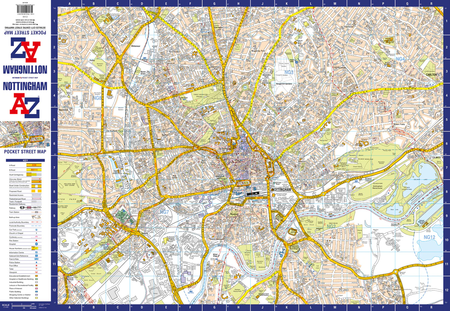
This up-to-date, folded A-Z street map includes all of the 1,500 streets in and around Nottingham.
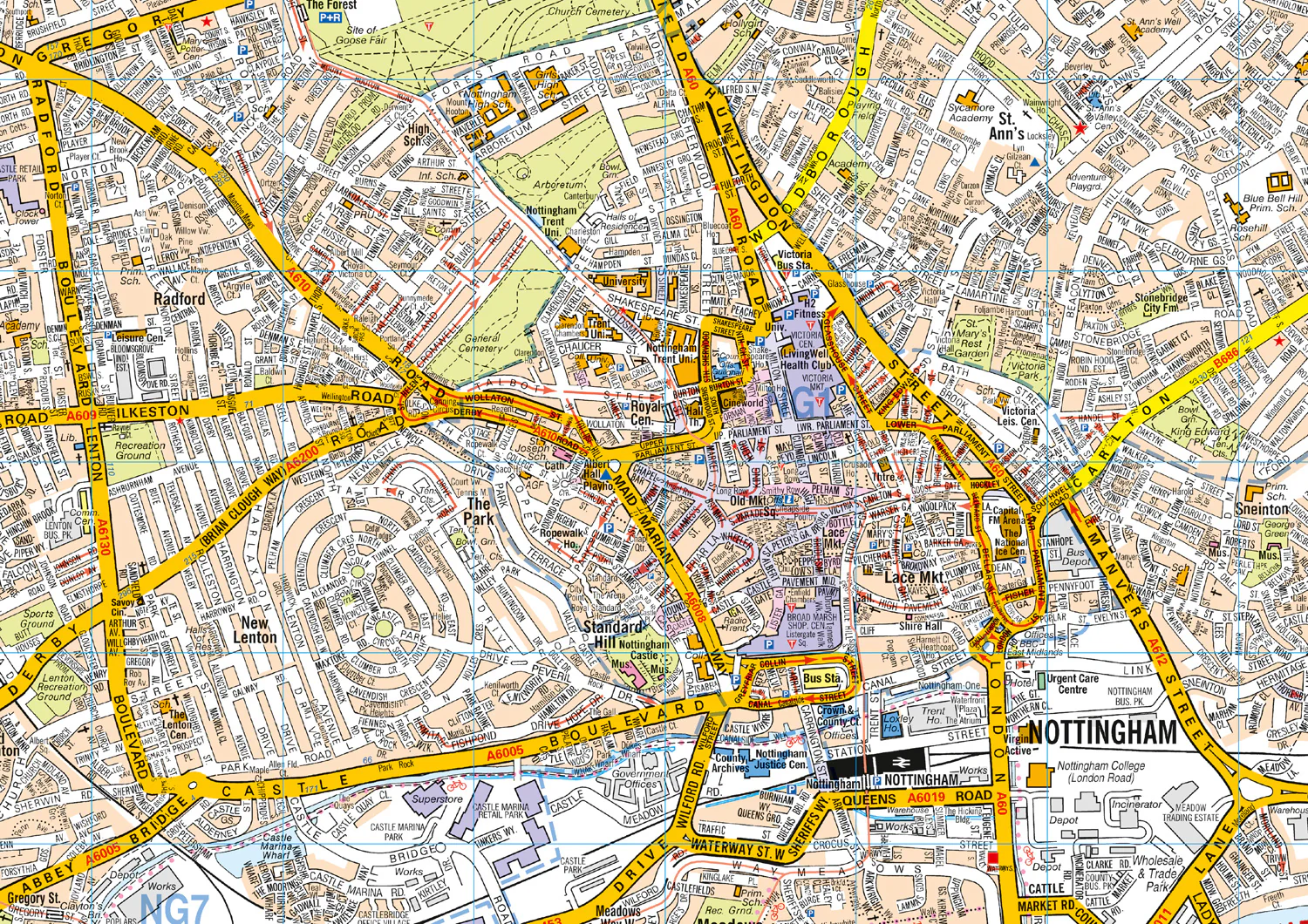
As well as Nottingham Castle and Lace Market, the other areas covered include Willford Village, Dunkirk, the Meadows, New Lenton, Old Radford, Thorneywood, Alexandra Park, Aspley, Forest Fields, Highbury Vale and Woodthorpe.
The large-scale street map includes the following:
• Places of interest
• Postcode districts, one-way streets and car parks
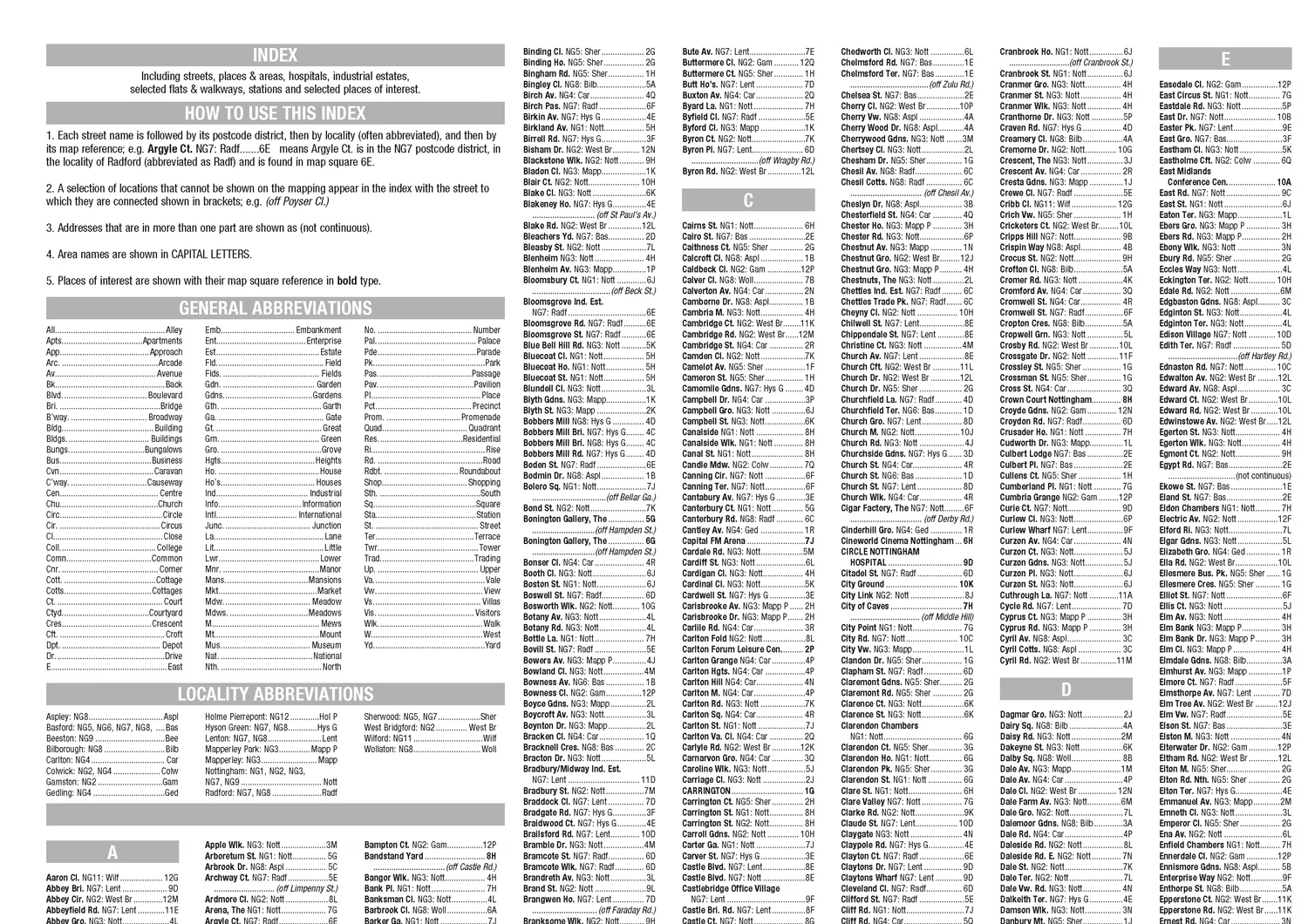
• Index to streets, places of interest, place and area names, park and ride sites, national rail stations, hospitals and hospices
The perfect reference map for finding your way around Nottingham.
Original: $5.35
-65%$5.35
$1.87
Description
Navigate your way around Nottingham with detailed street maps from A-Z
This up-to-date, folded A-Z street map includes all of the 1,500 streets in and around Nottingham.
As well as Nottingham Castle and Lace Market, the other areas covered include Willford Village, Dunkirk, the Meadows, New Lenton, Old Radford, Thorneywood, Alexandra Park, Aspley, Forest Fields, Highbury Vale and Woodthorpe.
The large-scale street map includes the following:
• Places of interest
• Postcode districts, one-way streets and car parks
• Index to streets, places of interest, place and area names, park and ride sites, national rail stations, hospitals and hospices
The perfect reference map for finding your way around Nottingham.