Collins School Atlases - Collins Junior Atlas: (Sixth edition)
The must-have Atlas for Year 6
Fully revised and updated, this is an ideal world reference atlas for young primary school geographers aged 8-11 years (Key Stage 2). Published in association with the Geographical Association, it enables children to learn about the world today and understand how maps and atlases work.
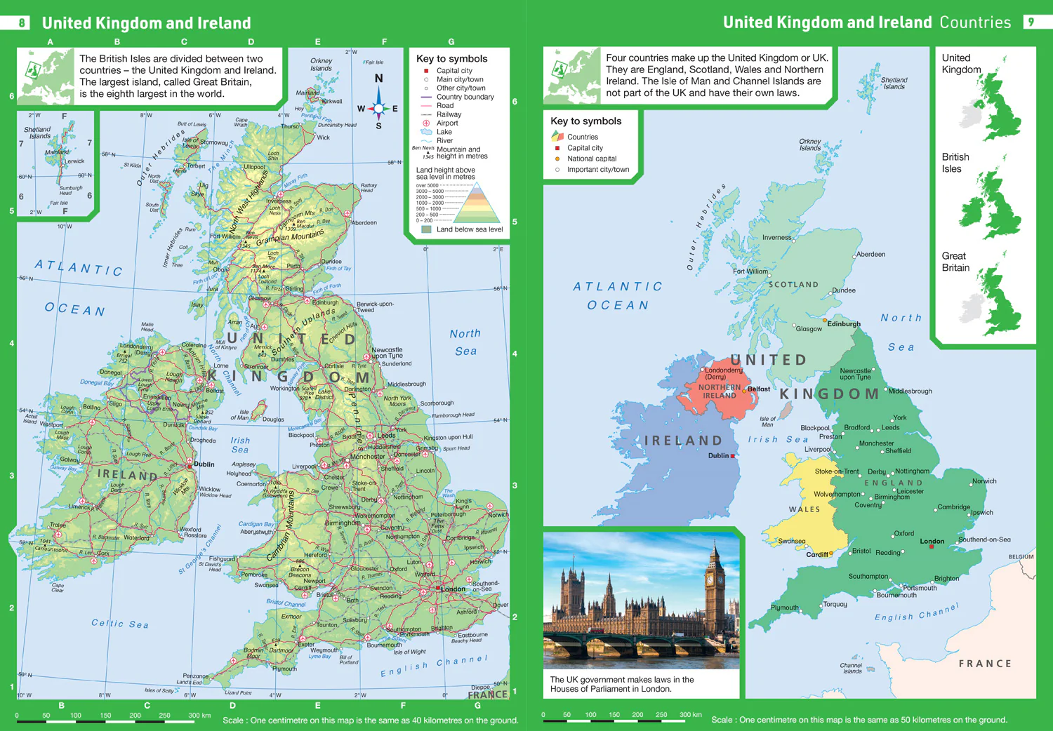
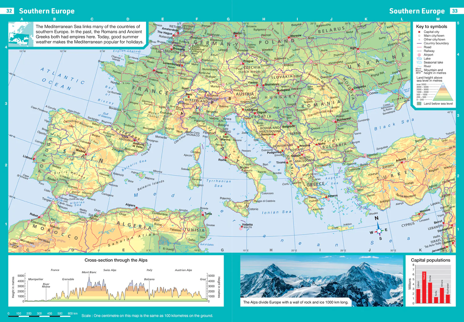
- The atlas is organised into sections covering the UK, Europe, the world and continents with more detailed larger scale maps of countries and regions popular for focus studies.
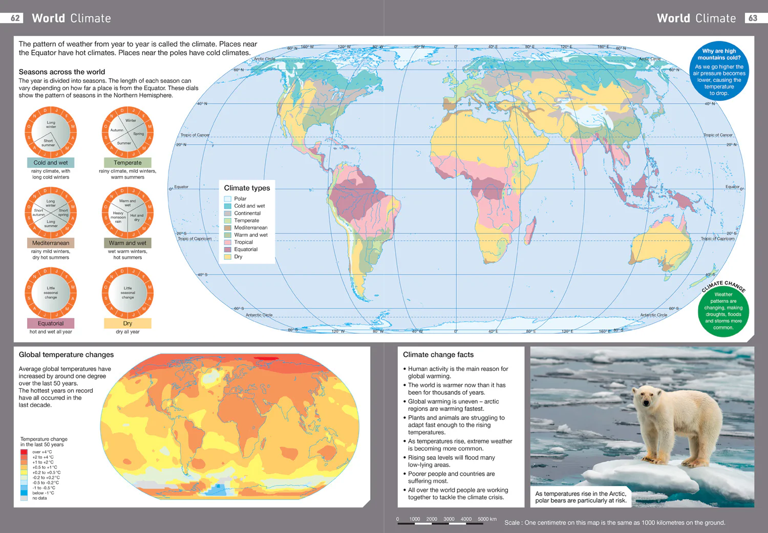
- It includes topics such as climate, population, migration, trade and environmental issues.
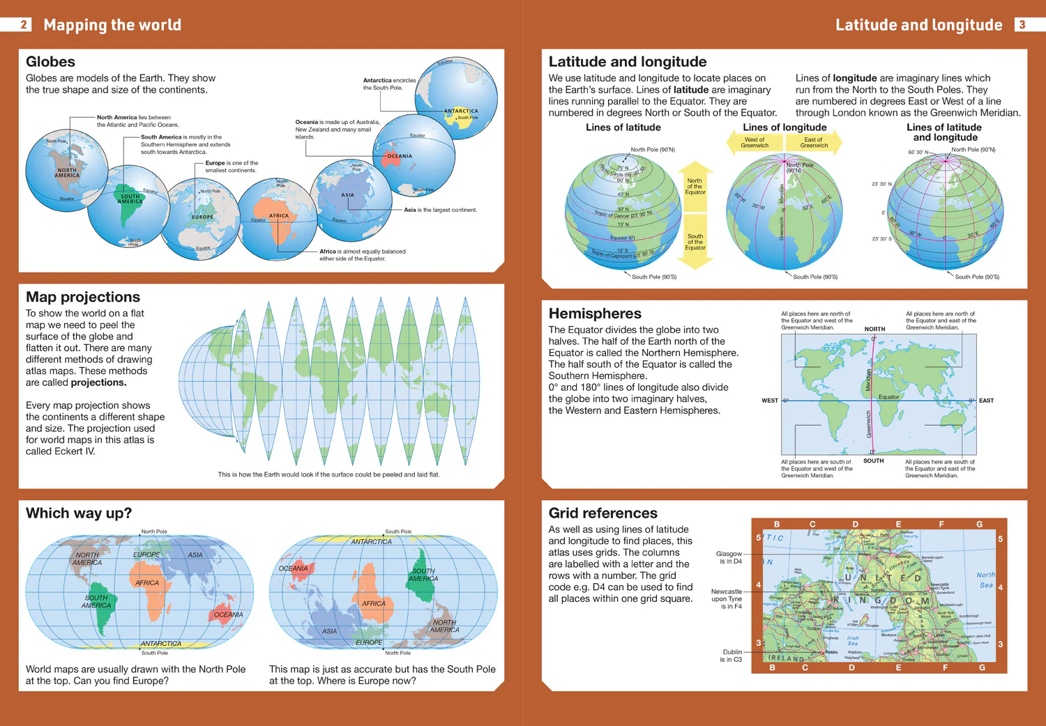
- Topographical based mapping helps the young geographer understand the processes which take place during the formation of the earth’s landscapes.
- The reference mapping is designed for maximum clarity and accessibility, and is supported by photographs and data boxes, with detailed map keys and scale information on each map.
- Specially selected topic maps give additional information linking to knowledge and understanding of distant places.
- Tables of key world country data include an Ecological Footprint figure for each country.
$4.22
Original: $12.05
-65%Collins School Atlases - Collins Junior Atlas: (Sixth edition)—
$12.05
$4.22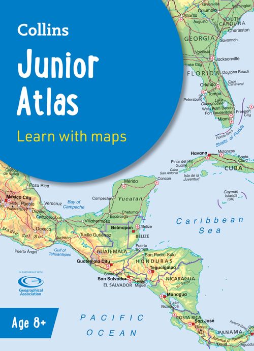
Description
The must-have Atlas for Year 6
Fully revised and updated, this is an ideal world reference atlas for young primary school geographers aged 8-11 years (Key Stage 2). Published in association with the Geographical Association, it enables children to learn about the world today and understand how maps and atlases work.
- The atlas is organised into sections covering the UK, Europe, the world and continents with more detailed larger scale maps of countries and regions popular for focus studies.
- It includes topics such as climate, population, migration, trade and environmental issues.
- Topographical based mapping helps the young geographer understand the processes which take place during the formation of the earth’s landscapes.
- The reference mapping is designed for maximum clarity and accessibility, and is supported by photographs and data boxes, with detailed map keys and scale information on each map.
- Specially selected topic maps give additional information linking to knowledge and understanding of distant places.
- Tables of key world country data include an Ecological Footprint figure for each country.